

The Bermuda Railway Trail is one of the most famous trails in the nationthat is spread over 26 miles. It is an abandoned rail bed that coversthe maximum part of the island. The trail stretches from St. Georgein the east and continues till Somerset in the west. It is one of thebest-known opportunities that offer great off-road running inBermuda. It also provides the links to some of the other walk andcycling trails on the island.
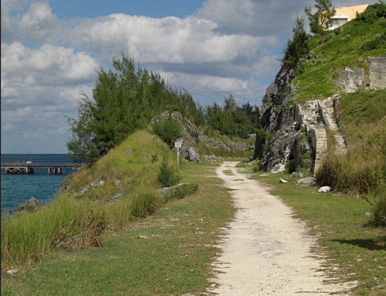
TheRailway Trail consists of a wide variety of parks, farms, fields andhistoric sections. The beautiful coastal sections and the lushfoliage work to add on to its beauty. It consists of a wide range ofsurfaces. Some of the most common ones include tough, narrow sports,hard dirt roads and some are even paved. The trail is known to endabruptly in some sections and force the visitors to use connectingroads. Some only have a narrow sidewalk. Not all portions of thetrail are reflected on maps and there are multiple breaks on thetrail as well. But once you get started on the route, the trail iswell-signed all by itself. While there are coastal sections mainlytowards the eastern side from Hamilton, some go into interiors aswell. There are seven main sections on this trail that coversmultiple areas and entry points.
Section 1
Thissection is known to have been once used as the railway terminal forBermuda. It starts from the Somerset bus terminal towards Bermuda’swestern end. The section is known to stretch for a little over 2miles and goes east towards the famous bridge of Somerset. It hasmultiple entry points including Beacon Hill Road, Scotts Hill Road,Scaur Hill Fort Park, and many others and is known to pass throughthe Sandy’s Parish.
Section 2
Thissection is also spread over the Sandy’s Parish and begins right atthe Somerset Bridge. It then stretches up right up till the Overpluslane in the area of the Evans Pond. It is stretched over the areas ofGilbert Nature Reserve, Skroggin’s Bay, Heydon Trust, Harmon’sBay, and Scaur Hill Fort. This section has just two entry points –one from the George’s Bay Road and the other from the Wharf Drivefrom the side of the Somerset Bridge. You can refer to the map tomore about this section.
Section 3
Section3 of the Railway Trail is relatively longer. The Southampton Parishand the Warwick Parish form the backbone for this stretch. Access tothe section is available from the side of the Overplus lane where itstarts and it continues till the Warwick Pond. It is known to passthrough a lot of landmarks including the Evans Pond, Evans Bay, WhaleBay, Jews Bay, Black Bay, Gibbs Hill Lighthouse and Khyber Pass amongmany other options. It has nine separate entry points including twopoints from the Tribe Road, the Church Road, Whale Bay Road, CampHill Road, and the Khyber Pass.
Section 4
Thisportion of the trail is known to pass through the Paget Parish andentry is possible from the Trimingham Hill on South Road in Paget.Signs have been efficiently set out to display the trail. It passesthrough a few main roads in this section but does not take long tore-enter the spice forests and farmlands. It includes the areas ofBelmont Hill Gold Course, Elbow Beach, Surinam Cherry Bushes andHarmony Club among many other places. There are 5 entry points tothis section with the Ord Road and South Road providing two entrypoints of their own.
Section 5
Themaximum portion of this section is covered through the DevonshireParish and the Smith’s Parish at some parts. Section 5 of the trailcan provide you with some exotic views of the shore on the north. Inthis section, you can see the main cruise ship channels that enterthe Hamilton Harbor and the Great Sound. It stretched over thePalmetto region, Gibbet Island and some other places. While PalmettoRoad offers the easiest entry point, there are three other optionsavailable as well.
Section 6
Thissection covers the most part of the Hamilton Parish and is stretchedover Bermuda Railway Museum, old chimney ruins, Coney’s Island, thebeach and the park at the Shelly Bay and parts of the Bailey Bay.There are multiple entries points to this section including the NorthShore Road, Bailey’s Road, the Bermuda Railway Museum and the ConeyIsland Road.
Section 7
Thelast section of the trail starts from the Ferry Reach Park andcontinues on till the point where the Ferry Road ends. It goesthrough the St. George Parish and covers some of the lovely areas inthe woodland along with coastlines from the park’s western ends.The trail ends at the St. George Town close to the Penno’s Wharf.The entry points for this section include Ferry Road, Bullet Bay Roadand Wellington Street.
These are all the notable sections of the trail that are available on themap. If you visit the place, you can ask the locals to share moreknowledge.
For more Travel Articles visit